
Map #36: April 24, 2017
Difficulty Level: 6
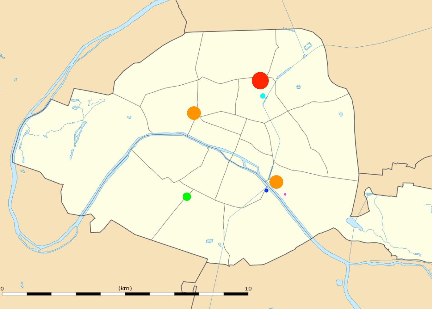
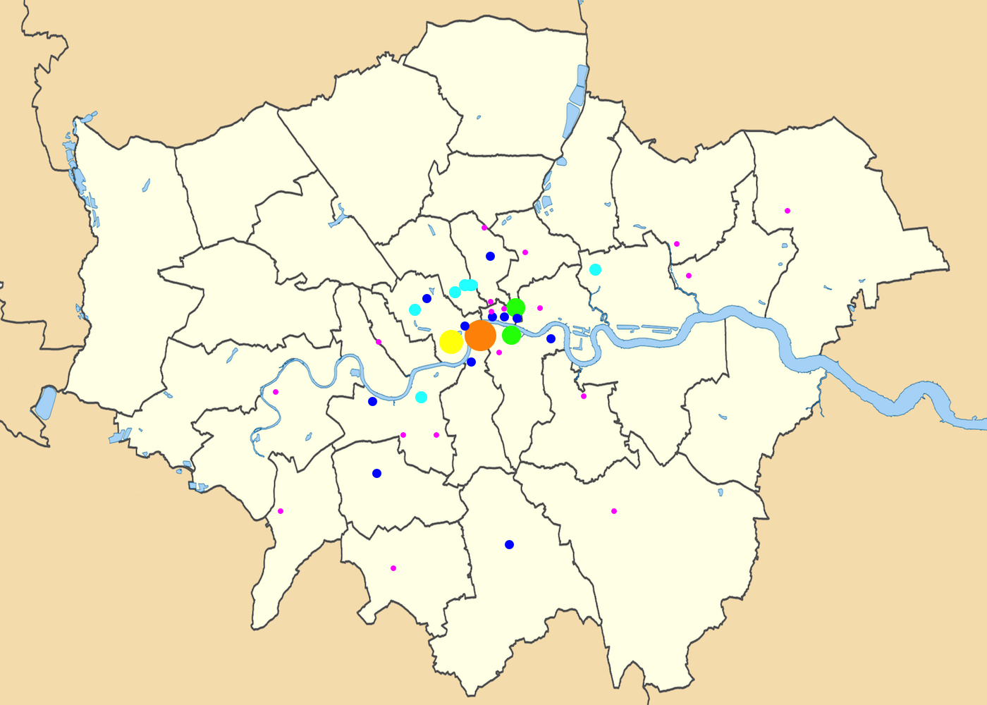
This week’s map is split into two pieces, each of which depicts a major world city. Here are links to larger versions of the first map and the second map.
This map is the first map in a five-week series. During this series, we will keep track of both the usual week-to-week scores and your cumulative score over the five-week period.
These maps are proportional symbol maps of two major world cities. (Do you need a refresher on what a proportional symbol map is? Visit our “Basics” page for a quick primer.) The base maps of the two cities do not have the same geographic scale, but the symbols have the same scale—in other words, an orange dot on the first map and an orange dot on the second map indicate exactly the same thing. Your job is to figure out what these proportional symbol maps represent.
Stumped? Check back Tuesday, Wednesday, Thursday, and Friday for hints about where to focus your investigation. The answer will be posted on Monday, May 1. Good luck!
Tuesday’s hint: The cities in these maps should be fairly recognizable by the looping courses of the famous rivers that flow through them. The map on the left depicts Paris, which is bisected by the Seine; the map on the right shows London, home to the Thames. As mentioned above, the geographic scales on these maps are markedly different. Both London and Paris have a lot of suburbs, but much more area is under the authority of the mayor of London than the mayor of Paris. Even so, there are a lot more dots in central London than in central Paris. When you think about your solution to this map, you need to figure out why there is such a significant imbalance in dots between the two cities.
Wednesday’s hint: In the London borough of Camden, directly north of the orange circle, there are two overlapping light blue dots. See the leftmost of these two dots? That dot is located about two hours and sixteen minutes away from the big red dot in Paris.
Thursday’s hint: If you use Google Maps or a similar site to zoom in on London or Paris to try to find where these dots are, you might find that it’s pretty tricky to tell exactly where the dots are. For London, here’s a useful trick: first look for where the bridges across the Thames would be, then try to see where those bridges line up with dots. There are several dots right along the shoreline that line up with bridges, including Waterloo Bridge, Blackfriars Bridge, and London Bridge. What would you find in the vicinity of those bridges?
Friday’s hint: The dots in central London seem to form a ring around the heart of the city. To help you visualize this ring, we have added stars to all the symbols on the map which are directly connected to the Circle Line, part of the London Underground. Why was the Circle Line built where it was? Why aren’t there dots directly in the middle of the city?
Answer: Click here to see an explanation of the answer to this week’s map question.
Next map: Click here to try out our newest map question.
