
Answer to Map #106
Click here for a full-size version of this week’s map.
Back to this week’s maps and hints.
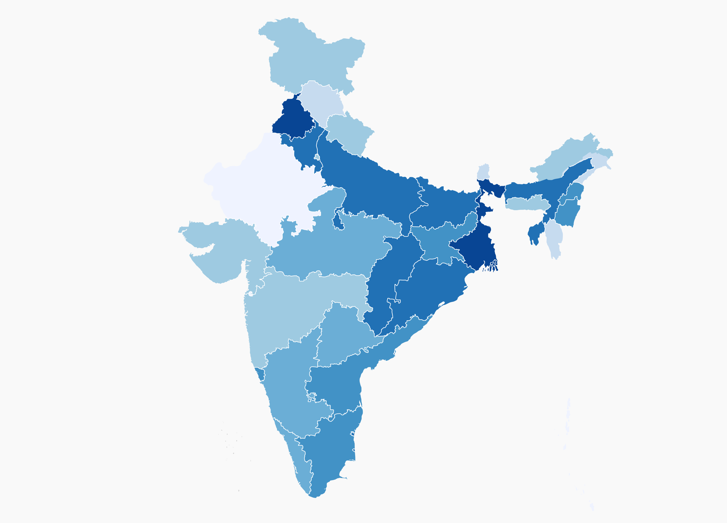
Answer: This week’s choropleth depicted the percentage of land in each Indian state that is used for cultivating rice.
The Reserve Bank of India publishes data showing the number of hectares used for various crops in the states of India. When we divide this data by the total land area of the states, we get a percentage. The highest percentage of land used for rice is in West Bengal, followed by Punjab and Bihar.
The fact that West Bengal heads this list should not be a surprise. That state is in a part of India that has exceptional access to water. Not only is that area subject to seasonal monsoons, but it is also in the vicinity of the Ganges River delta. Rice farmers, therefore, can easily flood their paddies.
On the opposite end of the spectrum is Rajasthan, which has the lowest percentage of land given to rice cultivation of India’s states. Much of Rajasthan is covered by the Thar Desert, which means it would be especially poorly suited to rice production.
The surprise that emerges from our list is Punjab, which is not in a particularly wet area. In fact, several decades ago, Punjab produced hardly any rice. But thanks to a sustained effort to develop new agricultural technologies known as the Green Revolution, scientists came up with ways to grow rice using far less water. Punjab has since become a major rice-producing area.
Next map: Click here to try out our newest map question.
