
Map #89: May 7, 2018
Difficulty Level: 7
Click here for a full-size version of this week’s map.
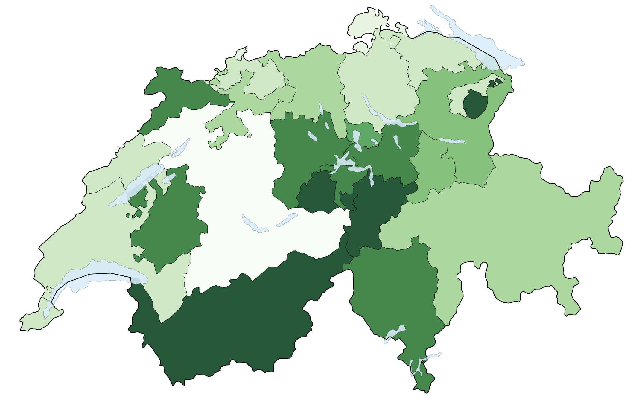
This map is a choropleth of the cantons of Switzerland. (Do you need a refresher on what a choropleth is? Visit our “Basics” page for a quick primer.) On this map, darker shades of green indicate that a canton has more of a particular statistic. As always, your job is to figure out what this choropleth represents.
Stumped? Check back Tuesday, Wednesday, Thursday, and Friday for hints about where to focus your investigation. The answer will be posted on Monday, May 14, 2018. Good luck!
Tuesday’s hint: The cantons of Switzerland have some very intricate boundaries, including a lot of exclaves. You may find these boundaries exasperating as you explore this map, but they actually contain a lot of clues. Wherever a boundary looks weird, there’s definitely a story behind it—and in many cases, that story will be relevant to this map.
Wednesday’s hint: What is most interesting about this map is how difficult it is to discern an overall pattern. That’s because there is such a dramatic difference between cantons, including cantons that share borders with one another. You also won’t find any relevant patterns based on neighboring countries (that is to say, the cantons that border Germany are not appreciably different from the cantons that border France, and so on). Instead, you should notice that there are roughly as many cantons that are quite dark as there are cantons that are quite light. Then you might want to focus your explorations on very dark cantons that are entirely surrounded by very light cantons.
Thursday’s hint: One of the most dramatic disparities on this map is the difference between the two Appenzell cantons in the eastern part of the country. What is a key difference between these two cantons?
Friday’s hint: Yesterday’s hint mentioned the two Appenzell cantons, which split from one another way back in the 1520s. They separated in order to prevent conflicts over religion, since each canton followed a different church. The religious patterns established way back in the 16th century remain very visible on a map of Switzerland today.
Answer: Click here to see an explanation of the answer to this week’s map question.
Next map: Click here to try out our newest map question.
