
Map #31: March 20, 2017
Difficulty Level: 4
Click here for a full-size version of this week’s map.
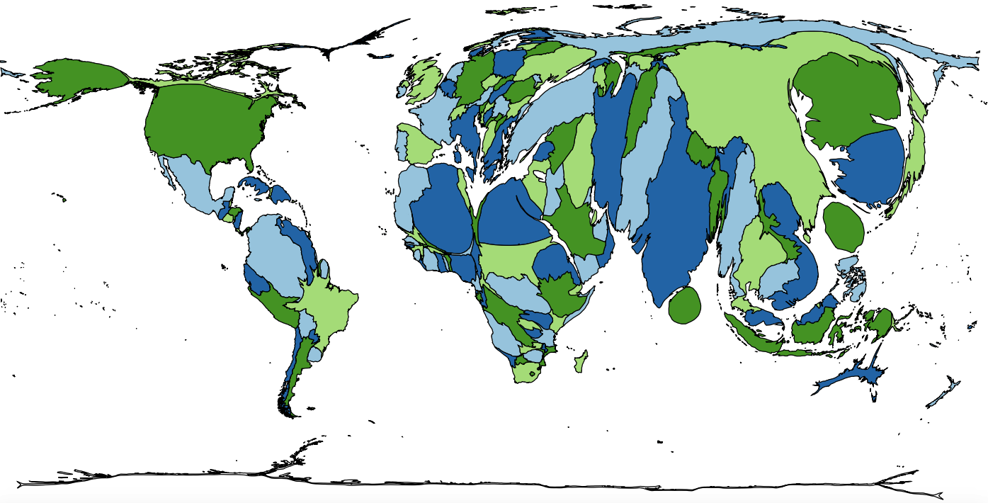
This map is a cartogram of the countries of the world. (Do you need a refresher on what a cartogram is? Visit our “Basics” page for a quick primer.) On this map, each country’s size is proportional to a particular statistic. As with all our cartograms, the colors on the map are only there to help you distinguish one country from another. Those of you who have paid attention to our cartograms in the past will remember that small countries wedged between large countries have a tendency to get distorted by the cartogram-making algorithm; in this case, the enlargement of Israel and Jordan meant that the West Bank had to be enlarged as well. We have left it uncolored because Palestine’s size on this cartogram should in fact be zero. Your job, as always, is to figure out what this cartogram represents.
Stumped? Check back Tuesday, Wednesday, Thursday, and Friday for hints about where to focus your investigation. The answer will be posted on Monday, March 27. Good luck!
Tuesday’s hint: One of the first things you’ll notice about this map is that it is somewhat correlated with population. That is, more populous countries—such as China, India, and the United States—tend to be larger on this cartogram. So what you need to look for are countries that stand out relative to what you would expect for a country with their populations. For example, take a look at Colombia. Colombia is the second most populous country in South America. It is slightly more populous than Argentina, but has only about a quarter the population of Brazil. On this cartogram, however, Colombia is noticeably larger than Brazil, and it’s almost six and a half times the size of Argentina. Why is Colombia so large on this cartogram? Try thinking about the recent history of Colombia and see if you can figure out a reason.
Wednesday’s hint: Yesterday’s hint suggested that you should look for countries that are enlarged beyond what you would normally expect for their population. The most extreme examples are all in East Asia. Taiwan, North Korea, and South Korea are all much larger than you might expect. Let’s focus in particular on North Korea. North Korea is the world’s 51st most populous country, but it is the fourth largest country on this cartogram (after China, India, and the United States). Think about what you know about North Korea. What do people do there? What are the priorities of the North Korean government?
Thursday’s hint: The most useful clues on this map are probably the smallest countries, not the biggest ones. The algorithm we use to make cartograms doesn’t always show very clearly the difference between countries with small areas and those with zero area at all. So for today’s hint, we’re going to tell you about the countries that have zero area. We already mentioned Palestine in the introduction to this map. Others include Costa Rica, Panama, Haiti, and Iceland, as well as many small islands in the Pacific Ocean and the Caribbean Sea. Can you figure out what these countries have in common?
Friday’s hint: We mentioned yesterday that Panama has zero area on this cartogram, but that hasn’t always been the case. Prior to 1990, Panama would have been represented on such a map. In 1989, the United States invaded Panama to overthrow the government of Manuel Noriega. What kind of government did Noriega preside over? Why, after Noriega’s ouster, might Panama have wished to be more like Costa Rica?
Answer: Click here to see an explanation of the answer to this week’s map question.
Next map: Click here to try out our newest map question.
